Cover image via Facebook page “Ty Tech Taiwan – Weather Express.” Other images via CWA.
By RK Shih / Staff
Taiwan’s Central Weather Administration (CWA) warned on Sunday that Typhoon Fung-Wong (颱風鳳凰) will almost certainly hit Taiwan early next week.
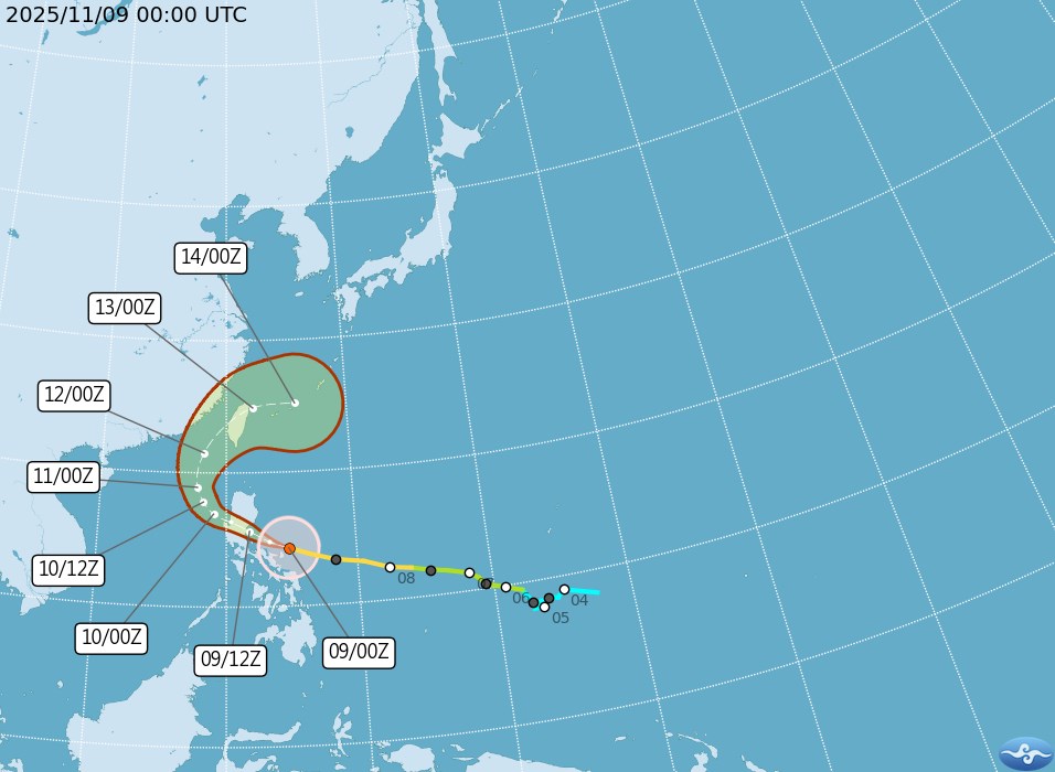
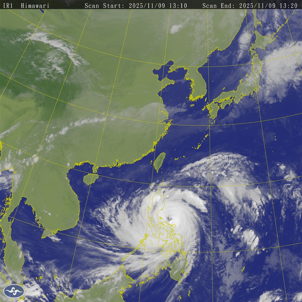
Currently located about 1,000 km southeast of Pingtung County’s Eluanbi, Fung-Wong has a radius of about 250 km, maximum sustained winds of just over 170 kph, and gusts reaching almost 210 kph, according to CWA data. The typhoon has intensified to the upper range of a moderate typhoon; however, it is expected to become the fifth strong typhoon of 2025 as of Sunday afternoon.
The storm is forecast to make landfall in northern Luzon in the Philippines late Monday before entering the South China Sea and turning north on Tuesday.
The typhoon’s outer wind field could reach southern Taiwan by Wednesday morning. Landfall is currently projected between Changhua and Tainan late Wednesday into early Thursday, but the typhoon should quickly weaken as it passes over Taiwan’s Central Mountain Range.
Where exactly it hits will depend a lot on how sharp that turn northward turns out to be. Experts say a smaller turn could send the storm across the Taiwan Strait, but a larger turn could place all areas from Miaoli to Pingtung within the impact zone.
What can be said with confidence now:
• Heavy rain is likely for Keelung, Yilan, Hualien, Taitung, and the mountainous areas of New Taipei
• Taipei may see periods of heavy rain on Tuesday from associated weather bands
• Central and southern Taiwan, as well as Penghu and Kinmen, should expect strong winds
Residents are advised to complete basic preparations and continue to monitor official forecasts. Officials caution against assuming minimal impact simply because the storm may weaken in classification.
Meanwhile, Taipower’s Kaohsiung branch says it’s on high alert with 224 engineers, 41 engineering vehicles, 25 cranes, and other equipment on standby.