
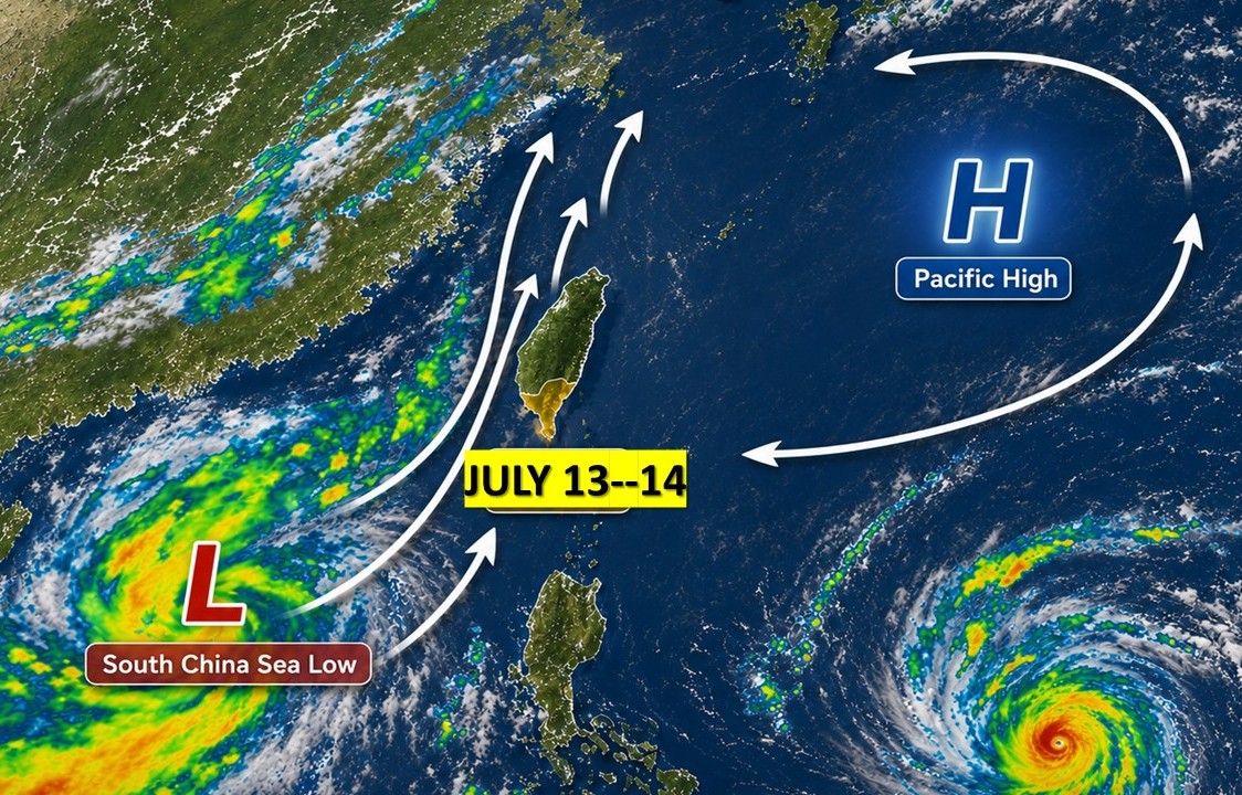
By KHT Staff. AI illustration image based on Weather Bureau data.
KAOHSIUNG — Strong winds swept across Kaohsiung from Monday afternoon into Tuesday, prompting some residents to compare the conditions to a typhoon.
Weather officials said the winds were caused by the combination of a tropical disturbance over the South China Sea and a Pacific high-pressure system to the east.
The two systems increased the difference in air pressure around Taiwan, strengthening southerly winds.
Airflow passing around the Central Mountain Range was also accelerated by the terrain, further increasing wind speeds along Kaohsiung’s coast and in exposed areas, the station said.
The strongest winds recorded in the city on Monday were at Nanliao Station (南寮站) in Mituo District (彌陀區), where average winds reached Beaufort force 7 and gusts reached force 9.
The CWA said the strong winds were expected to continue through Tuesday, with Kaohsiung remaining under a yellow land strong-wind advisory.
Local forecasts called for southerly winds of force 6 to 7, with gusts reaching force 10 near thunderstorms in some areas.
Residents were advised to secure outdoor objects and take extra care while driving, particularly on scooters and in exposed coastal areas.